Sat Nt through Tues Nt: Widespread record breaking heat is still on track for this weekend, with a few spots possibly breaking
records for the hottest June since records have been taken. We`re additionally focusing strongly on the dry thunder areal coverage
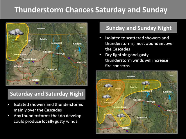
and timing. A secondary threat is wind. For thunder...a well-defined short-wave trough will move NE into the region Sunday and
Monday and likely be the main player as far as thunder areal coverage and intensity. Though the aforementioned wave won`t
arrive until late Sunday, we believe sfc-based convection in the form of isolated dry thunder will begin as early as late morning
Sunday. However, the real show will be Sunday Nt and Mon as a pronounced plume of elevated convective instability ahead of the
wave will not make this a purely "afternoon heating" event. The synoptic-scale forcing with the wave appears to be a sufficient
enough catalyst to release this instability...with a dry sub-cloud layer not allowing for heavy amnts of pcpn. this will
increase the dry lightning threat. Of note, however, is that we still have recent burn scars that can produce debris flows/flash
flooding with not a lot of rain. Once fropa occurs Sunday nt, gusty winds in and near the Cascades are expected Monday. Another
note... we`re watching closely the potential for a strong thunderstorm outflow winds first developing over SE Wa and the
Lewiston region, then spreading north toward Spokane. Stay tuned...bz
--- Area Forecast Discussion
National Weather Service Spokane WA
442 PM PDT FRI JUN 26 2015
My forecast
 Home
Home


