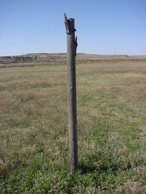
Published sectionals have notations regarding man-made obstructions. The sectionals do not indicate all the obstructions that could be interesting to the hang glider pilot, but those obstructions published for areas interesting to a particular HG pilot, are to be kept in his or her attention when flight planning and flying. However, again, map other obstructions on one's own local HG maps... paper, digital, and memory from exploration. Become an expert over the obstructions and hazards within one's HG flight realm: wires, poles, holes, trash, thorns, trees, roads, houses, fences, ravines, ... How do the obstructions and hazards look from the ground AND from the air? Practice "seeing" and interpreting what is seen; verify the nature of an obstruction.
Notice the idiosyncratic concerns about obstructions and hazards depending on the type of recreational hang gliding being lived; a HGP who flies one site and stays within or near that site would be mastering the obstructions and hazards of that site. Differently, a XC HGP would concern with many more obstructions and hazards. Identifying preferred LZs and flying conservatively to reach such LZs increases one's chance of flying in the future. However, things happen and preferred LZs may not be reached; know the territory really well. Advance visual-interpretation skills to support landing decisions.
[[Slightly edited text from the guide:]]
Obstruction symbols on sectionals show man-made vertical features that could affect safe navigation of aircraft. FAA’s Aeronautical Information Management (AIM) maintains a database of over 1,200,000 obstacles in the United States, Canada, the Caribbean, Mexico and U.S. Pacific Island Territories. Aeronautical Specialists evaluate each obstacle based on charting specifications before adding it to a visual chart. When a Specialist is not able to verify the position or elevation of an obstacle, it is marked UC, meaning it is “under construction” or being reported, but has not been verified.
The FAA uses a Digital Obstacle File (DOF) to collect and disseminate data. Because land and obstructions frequently change, the source data on obstructions and terrain is occasionally incomplete or not accurate enough for use in aeronautical publications. For example, when the FAA receives notification about an obstruction, and there is insufficient detail to determine its position and elevation, the FAA Flight Edit Program conducts an investigation. The Flight Edit crew visually verifies the cultural, topographic, and obstacle data. Charts are generally flight-checked every four years. This review includes checking for any obstruction that has been recently built, altered, or dismantled without proper notification.

- Screen Shot 2016-01-14 at 9.57.19 AM.png (16.09 KiB) Viewed 5077 times
============
DOF info:
http://www.faa.gov/air_traffic/flight_info/aeronav/digital_products/dof/ Here is a screen clip from DOF text file:

- Screen Shot 2016-01-14 at 10.17.22 AM.png (57.84 KiB) Viewed 5077 times
==============================
Local HG clubs could advance their libraries with maps, photos, and comments. Deliberate excursions to areas could continually increase awareness of local obstructions and hazards; and during such adventure, new launch and landing areas could be collected. When is that field with sensitive crops and when is the field in post harvest? What lands are with what kinds of fences; what is the signage? Who owns what? Are their chemicals that are hazards that might otherwise appear innocent? Where are guard dogs? Shooting ranges? Schools? Little-used roads? Communication lines? Power lines?


 Home
Home


