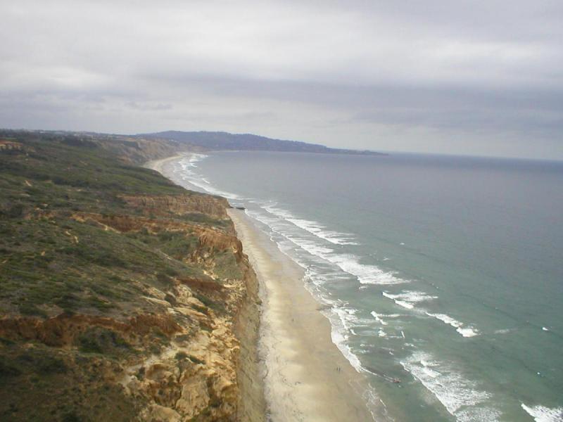
Here's a short tour of the Torrey Pines coastline from the pier to the point...
These were taken from my paraglider before the new rules limiting our flight were imposed...
Looking down on Scripps Pier:

Looking north from just over Scripps Pier:

Looking down on the park area just north of Scripps Pier:

Making it around the "corner building":

The mansions along the way to "Horizons" (aka burial grounds):

Looking north with Horizons on the right and bathtub rock (aka flat rock) in the distance:

Looking down on "Horizons" with lifeguard road in background:

Looking north over "Horizons" toward one of the largest mansions just north of the lifeguard road:

This mansion was being renovated at the time of this photo. At that time it had a single hole "golf course" right on the cliffs edge.

There's a little bowl north of the single hole golf course house followed by a mansion that juts out to a point lined with palm trees:

Just north of the "Palm Tree" mansion there's a gap that progresses to the northeast behind the southern "rhino horn":

This photo was taken above the southern "rhino horn" and shows the Gliderport along with the primary hiking trail:

The Torrey Pines Gliderport itself viewed from the south looking northeast:

The Torrey Pines Gliderport viewed from the southwest looking mostly east:

Looking north while in front of the Gliderport. The "RC Bowl" is on the right and the "North Face" is in the center. The Torrey Pines Golf Course is in the distance with flat rock visible on the far left point:

Looking back at the southern half of the "North Face" with the "RC Bowl" in the lower right, and the sailplane runway in the distance:

Looking north from a position just over the northern "rhino horn" on the "North Face". There's a gap between the North Face and the golf course::

Looking north while just beginning to cross the gap:

The Torrey Pines Golf Course itself just north of the gap. This is the 4th hole on the South Course:

Looking north near the 4th hole green on the South Course. There's a small bowl by the 4th hole green that often generates lift on light days. Just north of the 4th hole is a gap before the North Course begins. North Course holes 6 and 7 are visible in the distance. Bathtub rock (aka flat rock) is also visible sticking out into the ocean where the beach ends:

Looking north along the 7th hole on the North Course. There's a large bowl right along the 7th hole that generates lots of lift. It's a good place to gain altitude prior to heading further north where the cliff drops away:

Progressing northward toward Flat Rock / Bathtub Rock. The cliff is much lower here and generates much less lift:

Looking north just south of Flat Rock / Bathtub Rock. Flat Rock is just out of the frame to the left:

Just past Flat Rock / Bathtub Rock the cliff begins to rise again with several breaks. The formations of the cliff are stunning and the State Park contains overlook platforms for visitors. This was a particularly enjoyable section of the cliff, but it has been closed due to poor management of pilots by the Gliderport concession. Brad Hall promised to work on reopening this section but has accomplished nothing in almost 2 years.

Progressing further along toward "the Point", this photo shows some of the erosion formations:

There's another low point followed by a rise in terrain up by the Point:

One of several overlook platforms available to visitors. When this portion of the cliff was open, visitors would commonly wave and even ask questions. In my experience, this was always a positive interaction, and it's a shame that it's been closed:

More of the uniquely stunning erosion patterns along the ridge in the now forbidden State Park portion of the cliff:

The "Point" is marked by a high section of cliff which is perfect for soaring on west days:

The "Point" contains several trails and at least two overlook platforms:

There's a trail along the Point where spectators often stop to watch the flying (before it was banned):

Some of the last stands of Torrey Pines can be seen on top of the Point:

Just to the north of the Point, the cliff gives way to a section of flat land which typically generates no lift. This marks the north end of the normally soarable cliff:

A view to the northwest from the Point:

Looking south along the entire cliff. Scripps Pier is in the field of view to the south but is too small to be seen at this resolution:


